Note: Click on Solar System Exploration: Galileo Legacy Site (NASA-JPL) to get this image at its highest resolution.
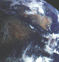
Visible in this image of northeast Africa and the Arabian Peninsula are most
of Egypt (left of center), including the Nile Valley, the Red Sea (slightly
above center), Israel, and Jordan.
In the center, below the coastal cloud, is Khartoum, at the confluence of
the Blue Nile and the White Nile.
Somalia (lower right) is partly covered by clouds.
December 9, 1992. Range, 500,000 kilometers (310,000 miles).
This color image of North-East Africa and Arabia was taken as Galileo left the Earth en route to Jupiter.
Next slide: North Polar Region of Moon
Back to: Galileo To Jupiter
Link to: Solar System Exploration: Galileo Legacy Site (NASA - JPL)
Updated: October 2 '96
Best seen with MS Internet Explorer.
Back: ARVAL - Image Gallery
Messages: